[#5 Ireland – Scotland 2024] from Jura to Loch Melfort, via the Corryvreckan

KarukExplo
14 May 2024
Association Karukinka
Loi 1901 - d'intérêt général
Derniers articles

Suivez nous

Sheltered in a loch on the west coast of Jura, we let the bad weather pass and took advantage of the stopover to hike on land, read and rest.
The generally ocher vegetation at the end of winter is currently undergoing spring change and is gradually turning green. The ferns unfurl little by little and entire fields of blue flowers adorn the horizon, in the form of patches. The barnacled geese and terns also stop with us in this loch, and participate in the soundscape of the cries of pheasants, the comings and goings of deer, cormorants, otters, and the song of the cuckoo.
Equipped with two bothies (unguarded shelters), this loch is also a paradise for hikers leaving with tent and backpack from the port of Craighouse, the only village on the island served by the ferry. Among the hiking ideas for next time, we will keep that of the three Paps, the three main peaks of the island which are the Beinn an Òir (the mountain of gold in Gaelic, 785 m), the Beinn Shiantaidh (the mountain sacred in Gaelic, 755 m) and the Beinn a’ Chaolais (the strait mountain in Gaelic, 734 m). For the pronunciation… figure it out 😉


After this stopover, we continued our way north. The initial objective was to anchor in a loch in the south of the Isle of Mull but the wind having chosen a different direction than expected, we finally decided to change course and approach a mythical place and not only for sailors: the Corryvreckan.
At the end of the afternoon, still under sail (NE 6 Beaufort wind and rough seas) and after having rechecked the tide times three times and consulted almost all the information within our reach (!), we timidly pointed the nose over the strait and continued, despite the cross currents, small whirlpools and other swirls, towards the only anchorage in the north of Jura: Bagh Gleann nam Muc (the bay of pigs). The conditions in good weather and slack water give everyone the opportunity to imagine the same journey in bad weather… The night at anchor was very peaceful, after a magnificent sunset and well sheltered from the wind.

The bad reputation of this strait, approximately one nautical mile long, can be explained by several factors:
- the morphology of the bottom: imagine a large canyon underwater and put a column there (like the end of the ascent of the Dibona for the mountaineers who read us) suddenly increasing the depth from between 50 and more than 220m to …29m. This is where the “eddies” or whirlpools are created, making the Corryvreckan chasm the 3rd largest maelstrom in the world.
- tidal effects: add to this particular morphology the strong tidal currents in this location since it is directly open to the Atlantic Ocean. The current can reach more than 8 knots so if you miscalculate your move, in addition to not going where you had planned, you risk even finding yourself further than your starting point.
- The effects of the wind: if to the effects of tides is added a wind blowing in a direction contrary to the current, then it is even better because in addition to not moving forward (at best) or going backwards (most likely), you have stationary waves that can exceed 9 meters and there… well done, you have won your visit to Milagro to tell us all about this in detail!
- and finally the evocations of the place in popular culture and literature, which also do not really promise anything good in the event of miscalculation. Some examples: the roar of the abyss could be heard more than 10km away in the worst moments; for readers of Jules Verne, a quick glance in Rayon vert will take you to this place for the duration of a chapter; many times throughout history the locals would have favored the arrival of enemy ships in this place to make them disappear; and also the experience lived by George Orwell during a navigation there, shortly before completing his masterpiece 1984 a stone’s throw from the strait: Barnhill on the east coast of Jura.
In short, as you will have understood, we studied the question a little before setting out and it was even more timidly than the day before that we weighed anchor early in the morning to begin crossing from west to east. . Conditions were good and as expected the main eddies were active on the north shore of the strait. We were at the supposedly good time of the tide and yet, the crossing currents sometimes decided the direction of Milagro and her 45 tons. Far from the dangers and far from using the full power of the engine to systematically fight against it, it was quite fascinating to feel these effects (and also quite stressful for the helmsman). The guillemots carried by the current seemed happy to travel effortlessly, dipping their bills occasionally to catch passing food. On either side the landscape revealed harsh conditions: bare rock mottled with lichens and grasses, and no groves of trees. It was only at the exit that a small house perched on the island of Scarba appeared on our port side. Decision is made to return to experience the bad weather, protected inside.
Some images of this passage carried out under the sun and changing lights:


After a stop at the port of Craobh Haven, we headed towards Loch Melfort, for Damien’s reunion with the Kames Fish Farm.
Views: 27
The Corryvreckan: Scotland’s legendary maelstrom between Jura and Scarba
Deep in the waters between the Scottish isles of Jura and Scarba lies one of nature's most fearsome phenomena: the Corryvreckan whirlpool. This legendary maelstrom, known to mariners for over a millennium, represents far more than a navigational hazard—it embodies the...
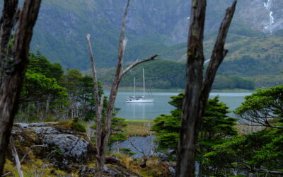
Patagonia Sailing Expeditions 2025-2026
Join us and discover the untamed beauty of the Patagonian Channels — While making a real difference Far to the south, at the very end of the Americas, lies a labyrinth of islands, fjords, glaciers, and wild ocean known as the Patagonian Channels. This is a region...
![[Heading South #13] From Buenos Aires (Argentina) to Puerto Williams (Chile) – Final Part](https://karukinka-exploration.com/wp-content/uploads/2025/07/IMG-20250124-WA0017-1-400x250.jpg)
[Heading South #13] From Buenos Aires (Argentina) to Puerto Williams (Chile) – Final Part
Logbook of our sailing journey in Argentine Tierra del Fuego, from Rio Grande to Ushuaia, via the Le Maire Strait, which separates the Mitre Peninsula and Isla de los Estados. #sailing in tierra del fuego A new morning dawns with magnificent sunshine! We leave Caleta...
![[#8 – Ireland–Scotland 2024] from Loch Buie to the sacred Isle of Iona](https://karukinka-exploration.com/wp-content/uploads/2024/07/Iona_LL-400x250.jpg)
[#8 – Ireland–Scotland 2024] from Loch Buie to the sacred Isle of Iona
Early in the morning, we raise anchor at the still and at a few cable lengths from Castle Moy on Loch Buie (Isle of Mull). In this loch facing south-west, last night was moderately pleasant, due to a small swell from the south that came before the wind forecast in the...
“Trip to the end of the world” from la Rochelle!
If you plan to go stop at La Rochelle this summer, don’t miss this trip to the end of the world! This sound and immersive fiction was created by Sébastien Laurier in collaboration with the Phare du bout du monde (Lighthouse of the end of the world) association and the...
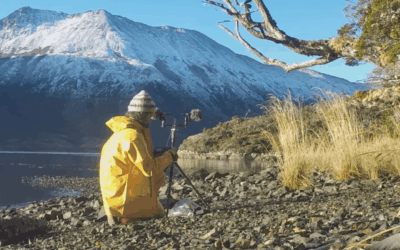
Waves, winds, animals… In Patagonia, Lauriane Lemasson collects the sounds of a forgotten world (Géo Aventure, by Sébastien Desurmont, March 6, 2020)
Ethno-acoustician Lauriane Lemasson (Founder and project manager - Karukinka) is passionate about the relationships that peoples weave with their sonic environment. Her profession drives her, microphone in hand, to brave the harsh expanses of Patagonia. Her goal: to...